Integración de datos geoespaciales en estudios estadísticos de accidentalidad
Road accidents have been a severe social problem and a subject of great interest for road safety researchers
and road transportation authorities. For some time, analyzing the factors that affect the likelihood
of vehicle crashes, formulating statistical models that best describe crash frequency and developing
measures that could improve road safety have been heavily researched topics.
The data commonly required to carry out accident analyses include road traffic and geometric
information accident report data, among others.
Traffic accidents are statistically “rare events”; therefore, it is necessary to work
with large samples and a large volume of data to obtain accurate models. Traditionally,
these datasets have been produced and managed by distinct official institutions with
multiple purposes and different formats and resolutions, facts that have notably hampered
the data integration process. Furthermore, the increasing number of sources providing
reliable information on the drivers’ performance, from navigation companies
and user-generated, offer possibilities to derive new information through data conflation
that was not available until recent times.
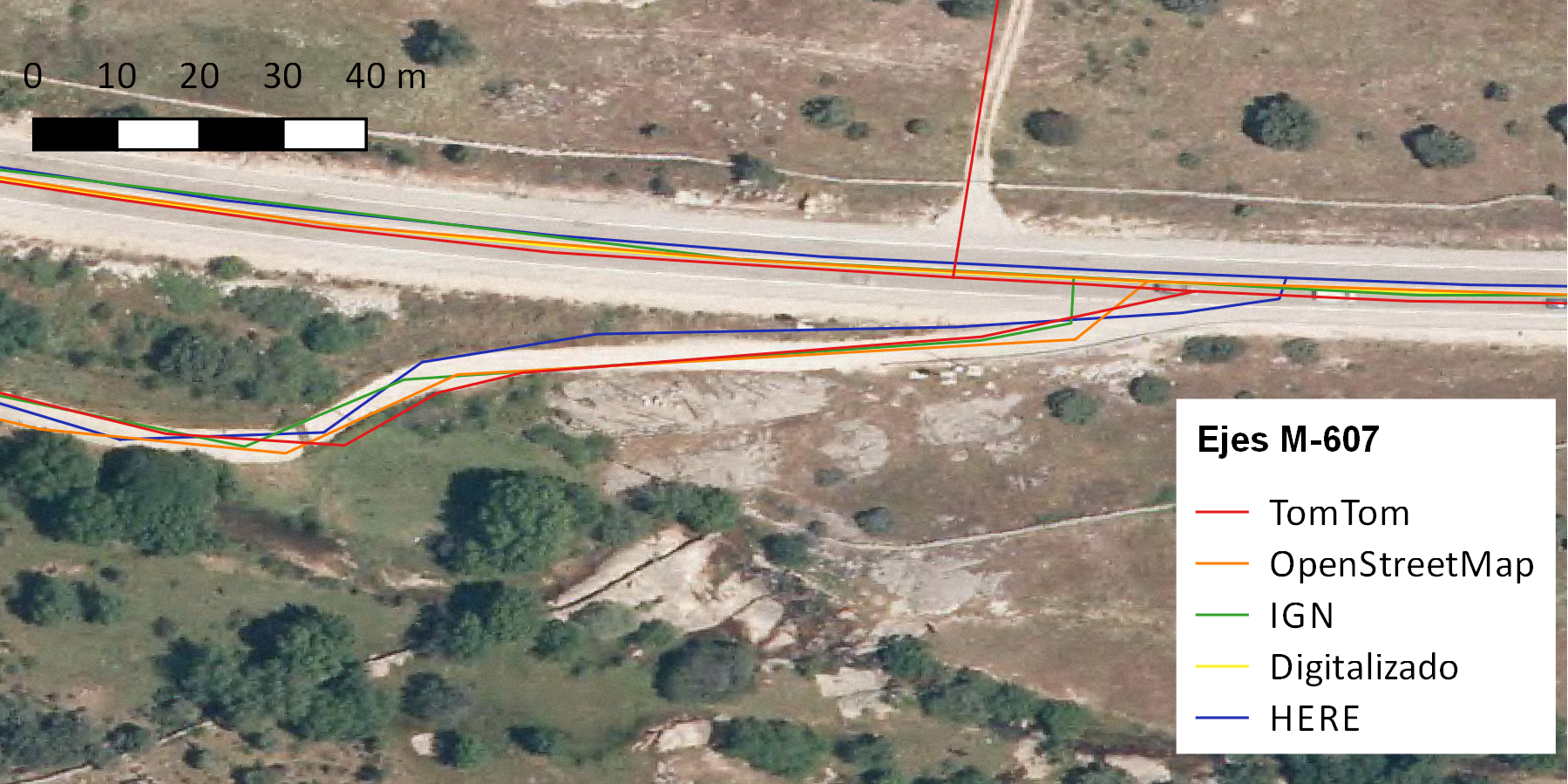
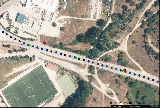
This paper analyzes distinct accident data sources, their formats, resolution, and spatial components
to evidence integration issues when formulating accident prediction models that consider spatial autocorrelation.
The analysis presents a practical case study on a highway from the region of Madrid.
This article can be found in spanish here